Saturday 28 July 2012

Pilbara - Mountains to the Coast


From Tom Price - highest town in W.A., (where we had about 1mm of rain overnight),  we called into Hammersley Gorge on the edge of Kurijini N.P.- the most interesting rock formations and colours we have seen, a waterfall over very large rocks into a beautiful, quiet, still poool of green clear water and tinyfish.
 Another 40km or so on sometimes very rough and dusty roads brought us to Mt Florence Station for lunch. The grassy site was very welcome and we sat under a tree reading books and watching birds. The station workers returned late in the day from mustering 600 cattle into a yard 30 km from the homestead. They came by battered utes, motorbikes and a helicopter. The camp park is surrounded by spinifex plains, but some big trees in the camp ground.


Despite all of our covering of vents there was  still a lot of dust in the van when we arrived at Millstream-Chinchester N.P. next day. This park is a real oasis in a semi arid environment. The Fortescue river has a wide bed which is fed by the Millstream which is filled from springs from an underground aquifer. The Parks Visitor Centre is the old homestead and much of the old garden of palms is still to be seen. The Millstream pool is beautiful with plants growing under the water, lily plants on the top and small fish easily seen in the clearest water we have ever seen.


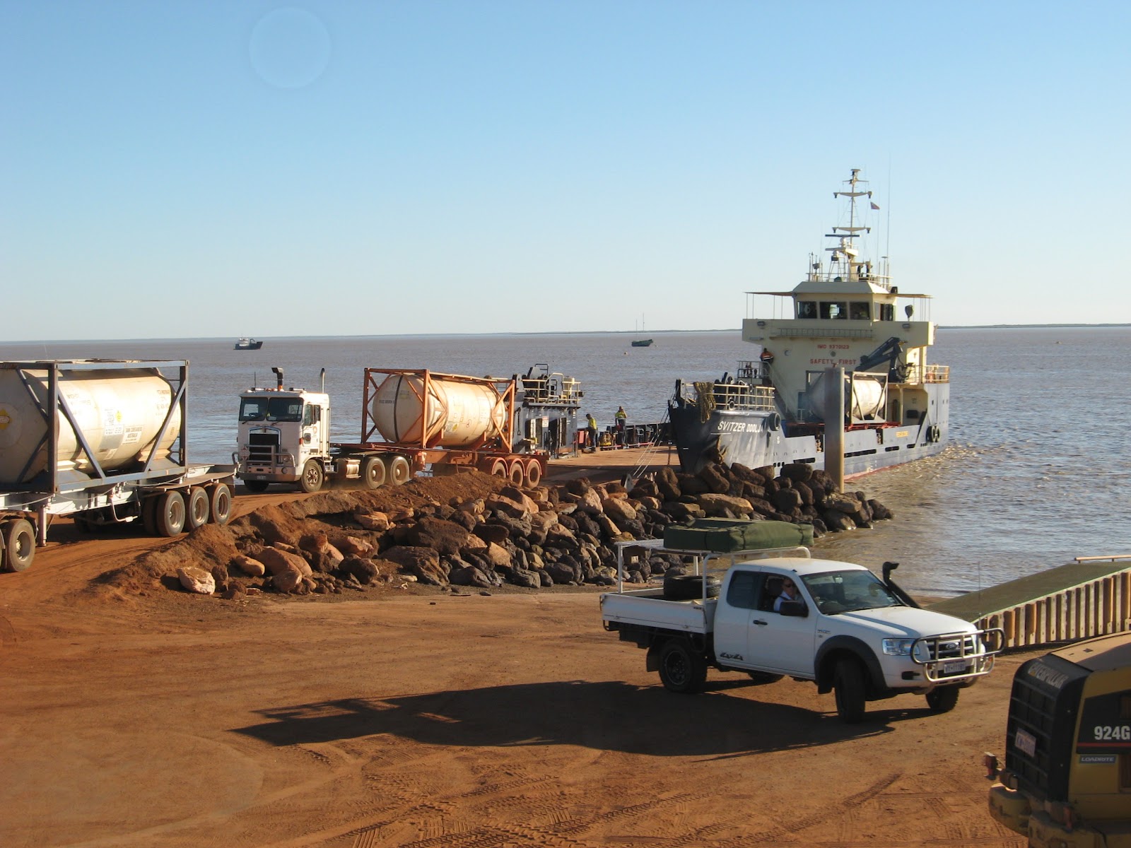
After a second lovely and lazy day in Millstream (including a 6km walk) we travelled over some terribly rough road toward Karratha, finally reaching bitumen with 100km to go. We travelled through some interesting country - small hills with exposed dark brown rocks tumbling down the side, looking like humans have dumped truck loads of unwanted rocks. Everywhere there was evidence of the mining industry. Railway lines (we saw 3 trains), new lines being built - work camps everywhere, powerlines criss- crossing over the hills, road trains, and of course the 4WD,s complete with flags and security codes on the side - we think we will put a sticker on our car - MBGNSAVAN  - that will make them think!


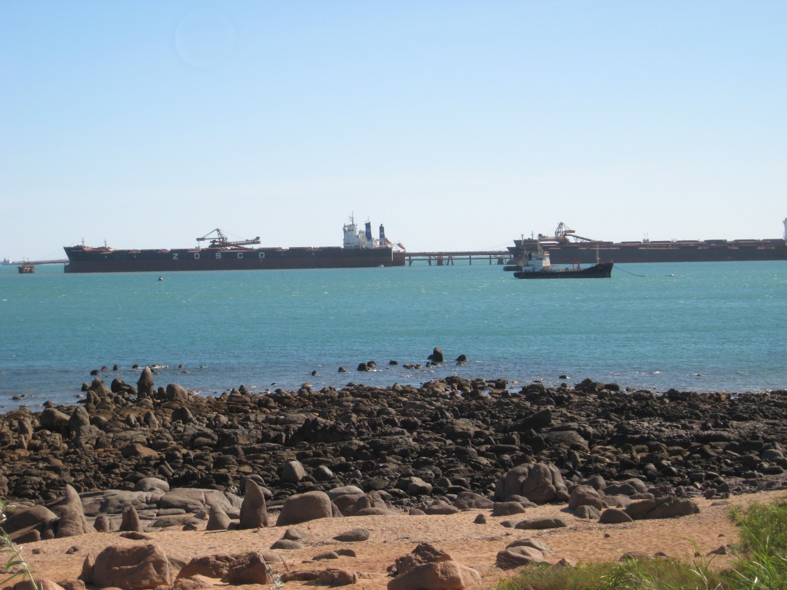
Two days in the Karratha / Dampier area saw us doing domestic things including trying to clean the inside of the van and washing the car. We also enjoyed learning about the area. As well as a major port for Rio Tinto - it's where all the trains come, it is also the base of the North West Shelf Gas Project. The extent of this project amazed us and the excellent visitor centre gave us plenty of information to absorb. An off shoot industry uses the natural gas to produce hydrogen and then liquid ammonia via the Haber process - for all those chemists out there. Dampier and all of the industry is on the Burrup Peninsula where very significant ancient rock art exists in sight of towers flaring gas. Karratha is the well planned dormitory town for the workers and is quite a pleasant place, nice parks, good schools and public buildings and a large shopping centre.

It was interesting to read in the local paper that the Dampier community, closely followed by the Karratha community, is the richest community in Australia. Over one quarter of the families have a weekly income over $4,000. Mind you house rentals are around $2,000 per week. It must be hard for a single shop assistant to live in these towns. Also, it seems as though the number of fly in fly out (FIFOS) workers is increasing as this is most economical system for the larger industries.
It was also interesting to learn that one of the Rio Tinto iron ore mines is now using driverless trucks. I don't know how it works but I hope they don't have too many computer gliches - those trucks cost about 6 million dollars each.
You can see we are learning heaps! Over the next 3 days we will be exploring the historic Point Samson, Roebourne and Cossack regions.


Friday 27 July 2012

House Update

Finally the rain has eased off, what a wet Winter it has been in Victoria. Consequently the block has dried off enough for the garage slab to be poured - about 5 weeks later than we had hoped for - poor Toph. But it's done and it looks good.


Looking at the photo has made us a litle bit home-sick, although we don't really have a home at the moment. We have been living in the Avan for 6 months now and despite the fact that the curtains are filthy, the door lock is broken, the stove is being held in place by 2 screws instead of 4, and outside it is a red instead of white colour, we are still travelling well and enjoying seeing this vaste country and learning new things.

Sunday 22 July 2012

The Pilbara


The Pilbara - if you think 'mining boom', 'colourful gorges', 'open spaces', you are correct, all of those things on a large scale.
On advice from locals in Marble Bar about road conditions we did not take route 138, the most direct road to Newman. Instead we took a fairly direct unsealed road to the Gt Northern Highway. 140km of good gravel road, no traffic, passing through undulating then flat country. Plenty of spinifex, trees in the river beds, interesting piles of rocks that looked as they had been stockpiled rather than natural. A very enjoyable trip under clear blue skies.


Near the end of this road there was a railway crossing with a train stretching out of sight in either direction. We had arrived in 'mining country'.

Boy, had we arrived. As we travelled down the Gt Northern Hwy, there was road train after road train. Some carrying ore, some fuel, some equipment, some massive tyres. I have never seen so many escort vehicles moving on-coming traffic over to the left as another oversize load went past. There were also heaps of dirty utes and 4WDs, each emblazoned with a large security identification code. The most amazing sight was equipment, at least 3 storeys high on a massive trailer with hundreds of wheels, pulled by two linked prime movers. Two of these  were in a rest area at the top of a rise and unfortunately we could not stop for a photo. The road would have had to be closed to other traffic when they were moving.


After reaching Newman we were able to make contact with Tristan and Catherine Cole, whom we first knew at Frankston when they were young children. Catherine's parents, Gary and Joy Scott, were visiting them and on Sunday we were able to have lunch with them all after sharing in worship at the Baptist Church. We were enthralled with Tristan's stories of his work He is employed by an Indigenous Community, funded by an NGO to preserve cultural and significant sites of the Martu people living in a number of communities on the edges of the Great Sandy Desert. His work has seen him travelling with an aboriginal elder while he sings a song taught to him by his grand father when he was a boy. The man had not been to the area before because the Martu were removed from the desert in the 1960's but through the song he was able to direct Tristan as he drove, leaving the track and going cross country, then leaving the vehicle and walking up a dry creek bed until finally reaching a fresh water spring, just where the song taught to him as a boy told him it would be. Tristan records the position of the site, it's condition and any preservation required. He manages a team of aboriginal rangers who are responsible for doing this work and often has to fly to Perth to report to the Board. He is very busy but obviously loves the work and receives great support from Catherine. Many of his stories about his experiences were very funny.

On Monday we did a tour of the Mt Whaleback Mine, a BHP Billiton mine and the largest open-cut mine in the world. Amazing to see the the size of the operation - massive trucks (60 of them, each of which uses 4,500L of diesel a day), conveyor belts, treatment plants, trains which don't stop - they move at 2km/hr beneath a hopper which fills each of the 323 trucks as they move through, before travelling the 8 hrs to Port Hedland on the longest privately owned railway in the world, where they dump their loads, once again without stopping. 


The next four days saw us in the wonderful Karijini N.P. - the main features are the deep, colourful gorges which you reach by walking down steep steps or climbing down ladders. At the bottom are pools of deep green water, huge paperbark trees, fern gardens, waterfalls, - we did lots of rock hopping but stopped when required to wade through freezing cold pools. Lookouts from the tops of the gorges gave some amazing views.


Unfortunately, I suffered with a tummy bug for one day which also slowed me done a bit for the next couple of days.

 We travelled on to Tom Price, another mining town but smaller than Newman and greener and neater. We are almost sick of the red dust, everything has a dark red sheen. The van and car, both inside and out, our clothes, the buildings in town, trees by the roadside, even the birds - the corellas in the park need a good wash. From here, after doing loads of washing and cleaning, we plan to travel to the Millstream - Chinchester N.P. and then back to the coast.


Mt Bruce, second highest mountain in W.A.


Friday 13 July 2012

Hottest Aussie Town in the World's Largest Shire

Where are they? You may well ask. Marble Bar of course.

Port Hedland - Marble Bar 200km

On almost the spur of the moment we decided to back track up the highway for 50 km, then turn off  and visit Marble Bar. The 'Big News' was that it was cloudy and looked like rain as we left Port Hedland. As it turned out there was a very slight drizzle for about 10 minutess and then it was sunny again. We enjoyed the drive to the Des Streckfuss rest area, a free roadside stop next to a waterhole. We sat in the sun for the afternoon, watching birds, reading and listening to passing road trains. We were amazed by the number of trucks carrying ore from inland mines to Port Hedland. They did go all night but we were a fair way from the road and Merilyn wasn't troubled by the noise. We shared a campfire and nice chat with a couple from Seymour. Next day as we approached Marble Bar we passed through some very attractive hills. Marble Bar is in the Guiness Book of Records as Australia's Hottest Town because in the Summer of 1924, for 161consecutive days leading up to 20 April, the temperature never dropped below 37.8 degrees C. That is Hot! Today, mid-winter, it was a cool 28 degrees - real nice! A man we chatted with in town who was visiting his 80 year old mother who won't ever leave the place, said that summers are unbearable. It is a very small town, but is in the largest Shire in the World - from the Indian Ocean high water mark to the Northern Territory Border.We enjoyed an historic walk around part of the town with some fine views from a lookout.


'. These two pictures are looking up the main street at 3 o'clock on Thursday afternoon. One shows the historic 'Iron Clad Pub' and the other the General Store/Post Office/Roadhouse. A young aboriginal boy had just come out of the store and was kicking a football across the road. It's not much bigger than Pomonal!
Can you spot the Bertram's A van?

Today (Friday) we completed the historic walk in the morning and after an early lunch drove to historic Comet Mine - a gold mine - where there was an interesting museum. On the way back we fossicked for Jaspar, took in the view at Flying Fox Lookout, recorded 19 species of birds at Chinaman Pool, and marvelled at the Jaspar that the original settlers thought was marble - hence the town's name. Altogether another very good day - no clouds again but a fairly cool breeze.

Tuesday 10 July 2012

Not so happy in Broome

Broome - Port Hedland  approx 600km


Our week in Broome was not quite what we expected. Everyone we met on the road said we must book at Broome or we would never get in. So, a couple of weeks ago I got on the phone and managed to get a park, Vacation Village, that could fit us in for a week. Thank goodness! It sounded OK - on the Port Road, a bit out of town, opposite the Golf Course. We were really looking forward to a week under the palm trees, relaxing next to the pool, riding to Cable Beach, lattes in China Town etc. a real tropical holiday!  The reality was that, although it wasn't a bad park, our site was hard against a wire fence which was about 8m from the Port Road which was probably the busiest road in Broome. Heavy traffic, including trucks, road trains, 4WDs, workers utes, motor bikes, started at 5.00 am and continued until 10.00pm and then quietened down a bit but still went all night. As well as the road to the port it also serviced the major light industry area in Broome. At times we had to shout to be heard. Several  people camped near us left early and lost their money ($45p/n)  - there were no refunds. It was not a restful place.


Our first two days were taken up with food shopping, trying to get my camera fixed (couldn't), trying to get the computer fixed - couldn't, ended up buying a new one - doing 3 loads of washing, and trying to catch up on some sleep - almost impossible. On the Friday we felt ready to explore Broome and just before we were about to leave Merilyn felt something 'go' in her back as she lifted the bed. The next 2 days for her were spent on the bed in agony.  The constant pain could only be eased by lying in a certain position. On Monday we got an appointment with a young physiotherapist who was able to manipulate her pelvis back into its correct position, and with deep massage and exercises the pain eased and after a couple of days she is now quite recovered. 
 
 I did manage to do some good rides around Broome, covering both sides of the Peninsula.

I had a good time on the Sunday afternoon when I visited the famous, and quite lovely, Cable Beach. I took the classic photo of the camels on the beach with palm trees in the background and then turned and took a photo of what you don't see in the promotion pictures - dozens of 4WD's parked on the beach so their occupants can swim or just look at the view. This is what the rich tourists pay to walk past on their camel ride!


As I walked from this part of the beach I counted 30 4WD's in a line waiting to get off the beach up the narrow winding track down which 20 or so vehicles were still coming on to the beach. It took about 20 minutes for the congestion to clear. All good fun at the beach on a Sunday. In fairness the main swimming area is separate from this part of the beach. The sand is white, clean, very wide at low tide, and you can lounge on it under an umbrella for only $30 a couple for half a day - how good is that!


When Merilyn was feeling better we did enjoy exploring China Town and learning about the Pearling industry - we also had some nice coffee. Unfortunately we were not able to book a tour we had planned for Cape Levique - fortunately as it turned out because Merilyn would not have been able to go. We left Broome with good feelings about the place but somewhat disappoined and far from relaxed.
Our next stop was at Port Smith, only 130km down the road, and this was a great place. Huge shady sites, quiet - we could hear the birds, with a lagoon which was just lovely. At high tide the water was clear and blue and at low tide you could walk, or drive, across the sand for 100's of metres - it was truly amazing. One day the park owner took us across the lagoon at high tide (gold coin donation to the Flying Doctor) and left us for 4 hours. We were able to walk to the Indian Ocean, wading through a shallow inlet on the way, and we were the only ones there, Awesome!
After 3 days we were feeling relaxed. Next stop was at Eighty Mile Beach, a couple of hundred kms down the road where we spent 3 nights. Very much a fishing place but also a lovely beach to walk along - we did 3 good walks and lots of reading, resting and chatting with neighbours. I only found out as we were leaving this morning that camped behind us, with his wife and two children, was Alex Julicher, a student of mine from Woodleigh. He now drives a tug on Darwin Harbour. We had a nice but brief chat.
  
This is high tide. When the tide is out the beach is almost 1km wide.

Today we have come on another couple of hundred kms to Port Hedland where we have done a good 20km bike ride. The Port is quite amazing with 3 km long trains bringing ore from inland mines to be shipped overseas. We counted over 25 ships waiting out at sea. There were at least 5 being loaded. Ten tugboats were at the dock, road trains were loading up from huge tanks to take fuel to the mines. There are cars with yellow lights on top, flags and large numbers on the sides everywhere, and almost everybody wears a flouro work jacket. A real industrial city. As we prepare for bed we can hear trains being shunted - they each have two locos in the front, two in the middle, and 232 trucks. From outside the van the horizen is a  mass of bright lights. We are only here for one night - it is school holidays and everything is booked. Tomorrow we might head inland to Marble Bar - why not!


Monday 2 July 2012

The Kimberly continued

Geikie Gorge
Geologists tell us that back in the Devonian Age much of Northern Australia was under the sea and during this time a massive coral reef, much like the Great Barrier reef, was formed. The land was raised, the water retreated and over eons of erosion much of the sandstone has been removed but the harder limestone of the reef remains and now exists in many places as an exposed range, often much higher than the surrounding country. Our first encounter with this reef/range was at Geikie Gorge where the mighty Fitzroy River has cut through the range. We did a one hour, Ranger led boat trip which was interesting and informative.


The lighter rock is limestone which has been polished by the river during the Wet and shows the height of the river in a normal year, the 2011 Wet was some 3m above this height.The darker rock above this is weathered limestone with some traces of iron. The Fitzroy River is Australia's largest in terms of volume of water carried - they estimate that the 2011 flow would have filled the large reservoirs supplying Perths water in 10 minutes - the impact of the water on the walls of the Gorge produces many interesting formations. 


Returning back to camp at the Fitzroy River Lodge, which was a lovely park, we drove across the original crossing.


Tunnel Creek
Travelling west from Fitzroy Crossing we turned off the Highway on to a road that a large sign said was open to high clearance 4wd vehicles - not exactly us. The first 10kms were terrible, lots of sandy bits, then rocky, and some awful corrugations. Then it settled down to quite a good gravel road and we again encountered the Devonian Reef we were following. A long section over a river plain had been recently worked on and you could easily sit on 80km/hr. Then came the creek crossings! The first was small and easily crossed. The second had a gravel base and we dropped onto a few holes but kept traction and pulled through OK, although we were a bit nervous by now because we had only seen one other vehicle for the morning. The third was much wider than the other two and as we found out, much deeper. We slowly crossed with some water splashing over the bonnet, hoping there would be no holes to swallow us up. In the middle I thought 'This is it, we are in trouble', but we weren't, we just kept going. The fourth was only a short distance across but we could see the opposite side was  steep and muddy with a distinct ledge to be negotiated just above the water line. Once again the Santa Fe easily got us through. We were  relieved to reach the Tunnel Creel N.P. and you can imagine our suprise to find the carpark full of 4WD,s and a couple of tourist buses. They had come from the Derby direction. You can also imagine our suprise when we opened the van to have a much needed morning coffee, to discover the fridge door completely off and much of the fridge contents on the floor mingled with the contents of the cutlery draw which had lost it's front panel - it had been a rough road. We were able to get things back together - thank goodness for gaffer tape. And then it was off to explore Tunnel Creek, which proved to be quite a highlight.


The tunnel was formed by a creek actually following fault lines through the range and over the centurys carving out huge caverns. We had to wade for much of the 750m and needed torches to find our way and to see the features of the caves. In about the middle the roof had collapsed providing a sunny, sandy, break along the way. The caves are home to many bats, fish and sometimes freshwater crocodiles.
Heading in


Half way

From Tunnel Creek we travelled over very corrugated road to Windjana Gorge National Park where we set up camp for a late lunch and restored order in the van. Merilyn wiped out and restored the fridge, Bruce glued the drawer, tightened up some screws and washed the van floor, removing the art work of beetroot juice and red dust. Late in the day we did a short walk through the grassland along side the rocky range - that Devonian Reef again.


Windjana Gorge
Apart from the reef/range the surrounding country is grassland, with some larger eucalypts and boabs, as far as the eye can see. We  entered the gorge through a natural arch and immediately the yellow grasslands gave way to a tropical oasis with deep green pools and green trees and shrubs, at the base of immensely high, straight cliffs, quite overwhelming. Most of the walk was through the trees and bushes - especially large paperbarks with leaves hanging like weeping willows. Freshwater crocodiles were sunning themselves on the banks - we saw 3 groups of 4 or 5 altogether. We walked close to eroded limestone that was truly beautiful - pink with white marbling going through it. Just a beautiful place.


Derby                                                                                                                                              
We enjoyed two days exploring the town of Derby. One day we did 30km on our bikes. People would see us and say "we saw you down at the wharf this morning". Obviously we are very 'noticeable". I am not sure if it is our fashionable clothes, our striking looks or the fancy bikes.
Derby is on a sandy peninsula that juts out into wide mudflats. The town is about 1km from the port. A new bike track runs from the caravan park to the port and we enjoyed using it. We found the port quite fascinating with its semi-circular jetty. Tidal variations are huge - up to 11m, one of the highest in the world. This is because King Sound narrows markedly below Derby and the mighty Fitzroy River runs in at the bottom of the Sound. The combination of all the material the river brings down in the Wet with the high tidal flows results in the water being a very muddy colour.


Tide's out

 We were very interested watching a barge which serviced an island near the head of the Sound,  fuel up from a road train on the pier and then move to a ramp where it took on equipment for a mine on the island. All of this had to be done quickly and efficiently because if they miss the tide they end up sitting on the mud for 6 hours.


Derby's early history was closely associated with the development of the cattle industry in the Kimberly. Drovers brought cattle to the port over vast distances. Clashes with the aboriginal population was also part of the 'frontier' history of this region and reading about this at the historic Derby Gaol, an awful place, was quite disturbing. Many aboriginals were chained up in the gaol for up to two years for slaughtering a cow. This was less than 100 years ago.

50 cattle could water at this trough in the holding paddock.

Chained aboriginals were imprisoned inside this hollow boab on their way to the infamous Derby Gaol

A week in Broome will be the end of our Kimberly experience.